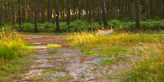
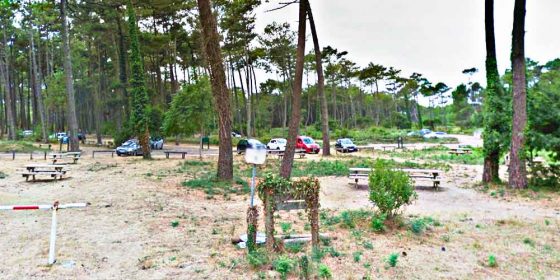
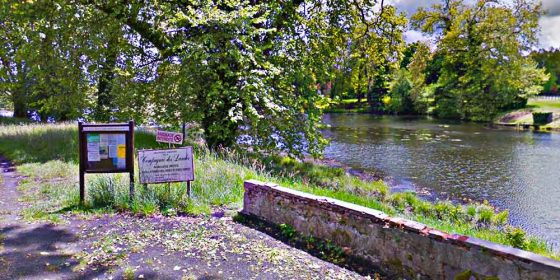
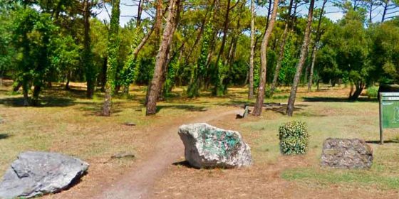
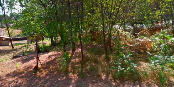
AZUR. Circular route "Pont du Loup" (11,3 km) (Click on image to enlarge)) Azur is a small village located a few kilometres north of Soustons and next to the lake (Étang de Soustons). This 11.3 km long, completely flat route (pictured left) starts in Azur itself, at the junction of rue Gaston Nougaro and the D-378, where the Espace François Mitterrand is located (pictured right). It runs mostly on country roads through the pines, but also includes some asphalt roads ...
AZUR. Route along the old railway (6,4 km) (Click on image to enlarge) Azur is a small village located a few kilometres north of Soustons and next to the lake (Étang de Soustons). This route (pictured left) is 6.4 km long and completely flat. It starts in Azur itself, at the junction of Rue Gaston Nougaro and the D-378, where the Espace François Mitterrand is located (pictured right), and runs along several sections of the old railway line in this ...
BISCARROSSE. Route along Biscarrosse Plage (9 km) (Click on image to enlarge) Biscarrosse (which, like almost all the coastal towns in Landes, is divided into two distinct areas, the Centre and the Beach; in our case, Biscarrosse and Biscarrose-Plage) is the last coastal town in the north of Landes; if we leave this town to continue northwards, we leave Landes and enter the department of Gironde, although both belong to the region of Nouvelle Aquitaine. The 9 km circular route ...
BISCARROSSE. Route between lakes (13,5 km) (Click on image to enlarge) Biscarrosse (which, like almost all the coastal towns in the Landes, is divided into two distinct areas, the Centre and the Beach (in this case, Biscarrosse and Biscarrose-Plage), is the last coastal town in the north of the Landes; if we leave this town to continue northwards, we leave the Landes and enter the department of Gironde, although both belong to the region of Nouvelle Aquitaine. This route starts ...
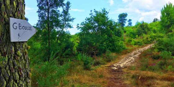
CAPBRETON. Circuit of Tuc of the nine churches (9,4 km) (Click on image to enlarge) Capbreton has become one of the most popular tourist areas in the Landes. The fact that it is a coastal town (with an estuary and two canals) and the increase in the number of tourist services on offer has meant that the number of tourists (mainly of Basque origin) has increased over the years. This route of the nine churches (circuit du Tuc des neuf ...
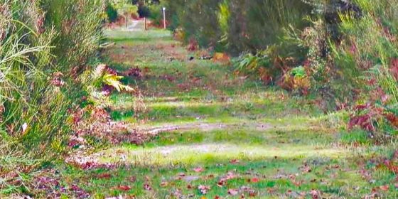
Circular route for hiking or mountain biking in Contis Plage (8,7 km) Of the many routes that can be done in the Landes, here is a particularly beautiful one. The route runs along forest paths and cycle paths, is between 8 and 10 kilometres long (we will show two variants) and is very easy to follow, making it accessible to all ages. You can see the complete route with Google Earth in this link. To download it and open it ...
CONTIS. Circular route on foot through Contis Sur Contis Plage is a village that is becoming increasingly popular, especially thanks to the Lous Serrots campsite, which welcomes a large number of visitors from April to October. But not many of them have visited the less touristic area known as Contis Sud, which is actually a neighbourhood belonging to Lit-et-Mixe called Les Pelindres. You can download this route to see it with Google Earth by following this link and clicking on ...
HOSSEGOR. Tour of the lake of Hossegor (7,4 km) (Click on image to enlarge) This route is really simple, as it is simply a round trip around the Lac D'Hossegor. To do this, there is an unpaved path that can be used by both people and bicycles and that completely surrounds the lake. We start the route here, on the Boulevard Notre Dame, right where the bridge begins. We go down the stairs (or pass between the two wooden barriers) ...
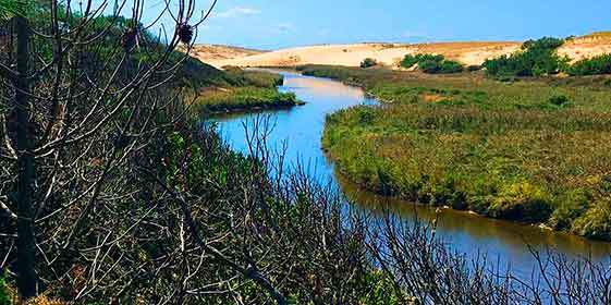
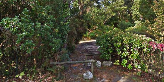
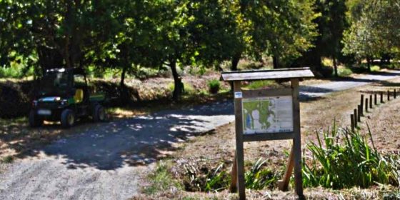
LEON - MOLIETS ET MAA. Ruta por la Reserva Natural de Huchet (8,5 km) The Courant D'Huchet nature reserve was created around this estuary in September 1981, a habitat which is home to a number of exotic trees, a multitude of birds (egret, osprey, night heron, eaglets, hawks, cormorants, etc.) and mammals (deer, otters, wild boar, etc.). This is perhaps the most visited route of the entire Landes coast, both on foot and by boat. It is not for nothing ...
LEVIGNAC. "Moulin Neuf" Route (8,5 km) (Click on image to enlarge) Levignac is a very small village, some twenty kilometres from the coast. It is not a tourist destination, but the cycle path from Cap de L'Homy to Lespero, which passes through Levignac, has turned this quiet village into a place of passage for a significant number of cycling tourists. This "Moulin nouveau" route is, like almost all the routes along the Landes coast, completely flat, and runs along forest ...
LEVIGNAC. Route de Barzague (8,7 km) (Click on image to enlarge) Levignac is a very small village, some twenty kilometres from the coast. It is not a tourist spot, but the piste cyclable linking Cap de L'Homy to Lespero, which passes through Levignac, has made this quiet commune a popular destination for a significant number of cycling tourists. This route is also completely flat, and runs mainly along forest paths, although at the beginning you have to ride along the ...
LINXE. Route of the Binaou Mill (7,0 km) (Click on image to enlarge) At that time it was not a castle as such, but a large bourgeois mansion with a wall clock above the main gate. However, a century ago now (in 1920), the then owner demolished the building and built the castle as it exists today. Linxe is a small village situated between Vielle Saint-Girons and Castets (the latter is located on the A63 motorway), with many wooden houses ...
LIT-ET-MIXE. Cap de l'Homy route (11,2 km) (Click on image to enlarge) An attractive route that starts at Cap de l'Homy, a charming district of Lit-et-Mixe on the coast. The route has a bit of everything: forest tracks, pistes cyclables, sandy areas, picnic areas... Although it's true that it's a bit long (11.2 km), it's worth it for its beauty and diversity. The start of this route is at Cap de L'Homy, opposite the entrance to the Cap De L'Homy ...
LIT-ET-MIXE. Health trail in the forest (4,0 km) (Hacer click en la imagen para verla en grande) On the road from Lit-et-Mixe to Cap de l'Homy, and 3 km from the village, two small routes (2.5 km and 1.5 km) have been organised, which are called in French "Health trails in the forest". The two trails are adjacent to each other, so that they can be done together. The name "health trails" refers to the fact that along the route ...
MESSANGES. Tour of the Lac de Moïsan (4,9 km) (Hacer click en la imagen para verla en grande) Messanges is a village located between Vieux Boucau and Moliets et Maa, through which the Velodyssee also passes. The route starts in the centre of the village and runs through two streets before entering a path that runs parallel to the stream (Ruisseau de la Prade) and leads directly to the small lake of Moïsan. Once around the periphery of the lake, ...
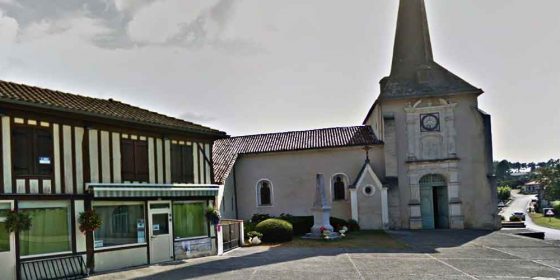
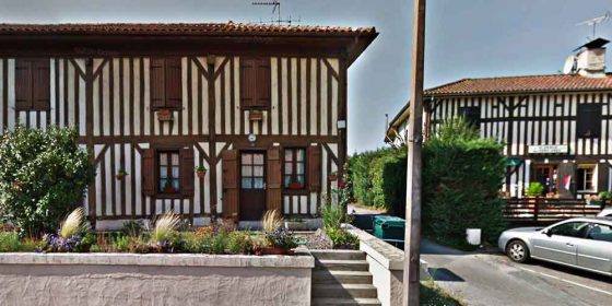
MÈZOS. Heritage Route (10,2 km) (Click on images to enlarge) Mèzos is located about 7 kilometres east of Saint-Julien-en-Born. This route, which runs along forest paths and narrow, traffic-free roads, offers a wide variety of landscapes, from the ever-present paths through pine trees to traditional Landaisian houses and beautiful spots crossed by frequent watercourses. In addition, the entire route is well signposted, alternating between the usual blue rectangle plaques and the green background signs indicating the cycle path. An important ...
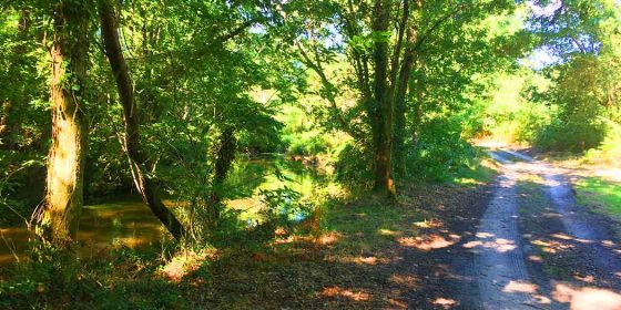
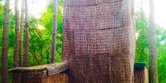
MIMIZAN. The BIOLOGICAL RESERVE of La Mailloueyre To the south of Mimizan Plage, on the outskirts, there is a beautiful site with two signposted walking trails. This is the biological reserve of La Mailloueyre, a word derived from the original Occitan Malhoèira (place of seagulls). In this paradisiacal enclave, you will find three of the elements that characterise the Landes flora: pine trees, dunes and wetlands. But the route also has some surprises, such as an observatory from which to ...
MIMIZAN. Lake and forest route (10 km) (Click on images to enlarge) A long but interesting route through Mimizan that offers several places of cultural interest and a walk around the beautiful lake of Aureilhan. Of particular interest, in our opinion, is that the route passes through the botanical garden of Mimizan, an inlet of land on the lake itself which has more than 300 species of plants, many of them exotic. In fact, it was rated in 2001 as ...
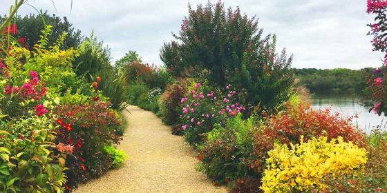
MIMIZAN. BOTANICAL GARDEN on the lake Mimizan is a beautiful village in the Landes region with many attractions to enjoy. One of them is its botanical garden ("Promenade fleurie" they call it there). It is a small island located just where the river ends and the lake of Mimizan-Aureilhan begins. This floral garden has more than 300 species of plants, and was qualified in 2001 as one of the "most beautiful flowered sites in France". In fact, since 1999, Mimizan ...
MOLIETS-ET-MAA. "La Prade stream and swing" route (12,6 km) (Click on images to enlarge) A long route (12.6 km) that tries to take in all the interesting places in this charming village in Landes. The circuit passes by the tourist office and the church, the lake and the stream of La Prade, the Moliets golf course, picnic areas, the busy street leading to the beach (Avenue de L'océan), the beginning of the Courant D'Huchet nature reserve and the lake of ...
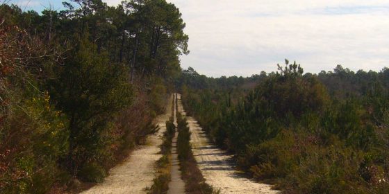
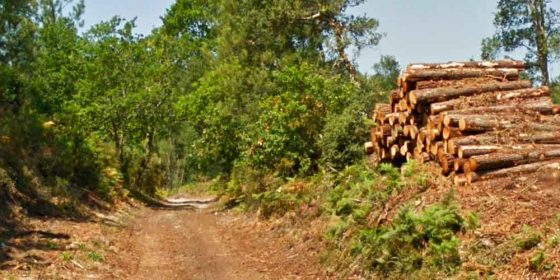
PONTENX-LES-FORGES. Route of the Courant des Forges (14,7 km) (Click on images to enlarge) Pontenx-les-Forges is a municipality to the east of Mimizan, to which it is linked, as well as by road, by the piste cyclable which runs from Mimizan Plage - Mimizan Bourg - Aureilhan - Saint-Paul-en-Born and Pontenx. The route is very long (14.7 km), but in reality it can be shortened to a third of that by doing only the small circuit closer to the centre ...
SAINT-JULIEN-EN-BORN. Routes of the Contis Estuary and the White Sand Plain (6,0 km y 10,9 km) (Click on images to enlarge) They are two routes in one, i.e. the long one (10.9 km) includes the short one (6.0 km). The difference is that at one point we turn right instead of following the course of the Ruisseau de Mézos to join the path back to Saint Julien. The entire route is perfectly signposted, with the characteristic white plaques and blue ...
SAINT-PAUL-EN-BORN. Route of history and landscapes (9,6 km) (Click on images to enlarge) This 9.5 km long route through Saint Paul en Born allows you to discover the natural and historical heritage of this area of Landes. You can see the alder forest and the shores of the lake of Aureilhan as well as the Thuc de Houns (the remains of an ancient mound of the castle dating from the 11th century), the site of the old church, the excavations ...
SANGUINET. Route of Lake Cazaux-Sanguinet (6,6 km) (Click on images to enlarge) Sanguinet is a town in the Landes region to the north-east of Biscarrosse and has been receiving a large number of tourists for some time now. It is no coincidence that there are a large number of campsites in this commune. This 6.6 km long route along the lake of Cazaux-Sanguinet is almost entirely on country tracks, a large part of which runs parallel to the lake. We ...
SEIGNOSE. Beaches route (5,3 km) (Click on images to enlarge) It is curious that this route is called the Circuit des plages (Beaches Circuit), because not only do we not walk on any beaches, but at no point along the way do we even catch a glimpse of the waves in the distance. Be that as it may, its 6.6 km length links the access roads to the beaches of Penon and Casernes, both in Sanguinet. Most of the route ...
SEIGNOSSE. The blue route of the "Tucs" (7,9 km) (Click on images to enlarge) This route starts near the Black Lake (Étang Noir), so called because of its depth, its muddy bottom and the shade provided by the trees on the shore. This lake is the centre of the Nature Reserve of the same name, a natural habitat that provides shelter and food for a large number of species such as the otter, the European mink, the European pond turtle, ...
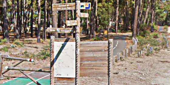
SOUSTONS. Route to discover the forest (5,4 km y 9,8 km) (Click on images to enlarge) This route is actually two routes, as the second (9.8 km) includes the first (5.4 km). The two routes are aptly named because, except at the starting point, they follow pretty paths through the woods. For those who live or spend their holidays in Vieux Boucau or Messanges, two tourist attractions, it is easy to reach this double route, as a piste cyclable links ...
VIELLE-SAINT-GIRONS. Route of Bareuyes (10,9 km) (Click on images to enlarge) Vielle-Saint-Girons is a small village in the Landes region which has so far managed to escape the masses of tourists despite the fact that there are two large campsites close to the beach, Campeole Les Tourterelles and Eurosol. This route shares a section with the other route (Route des Tucs) in Vielle-Saint-Girons; in fact, they are like two squares with a common cathetus, although the Bareuyes route is two kilometres longer ...
VIELLE-SAINT-GIRONS. Route of the Tucs (8,9 km) (Click on images to enlarge) Vielle-Saint-Girons is a small village in the Landes which has so far managed to escape the masses of tourists despite the fact that there are two large campsites close to the beach, Campeole Les Tourterelles and Eurosol. This route shares a section with the other route (Route of the Tucs) in Vielle-Saint-Girons; in fact, they are like two squares that have a cathetus in common, although this one in Bareuyes ...
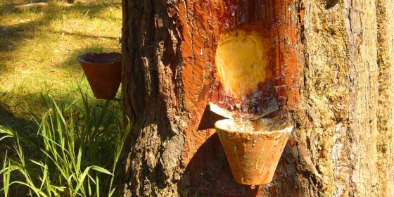
VIEUX BOUCAU. LA "PALOMBIERE" (Circular walk) On the outskirts of Vieux Boucau there is a signposted path that is as beautiful as it is interesting. It is a trail for all ages - it is just over two kilometres long - that runs through a beautiful grove of trees and has information panels that provide information - in French - on elements of the forest such as the history of the trees and the work with resin, mushrooms and ferns, ...
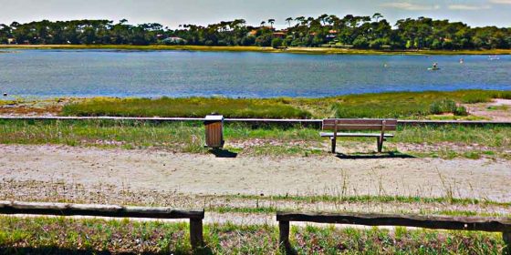
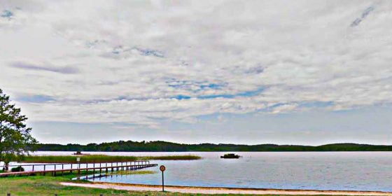
Tour of the Vieux Boucau lake (4 Km) Download map This beautiful route in Vieux Boucau Les Bains consists of going around the Marin de Port D'Albret lake. The route, which is 4 km long, is completely flat and can be done on foot or by bike. We started the walk from the end of Rue Mail Andre Rigal, next to the Tivoli bar. An asphalted track runs around the edge of the lake, so there is no need for ...