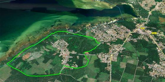
Sanguinet is a town in the Landes region to the north-east of Biscarrosse and has been receiving a large number of tourists for some time now. It is no coincidence that there are a large number of campsites in this commune.
This 6.6 km long route along the lake of Cazaux-Sanguinet is almost entirely on country tracks, a large part of which runs parallel to the lake.
We start the route at the jetty (Port de l'Estey) at the end of the Avenue de Losa, where there is a parking area. Instead of turning left onto the Chemin de l'Estey, we continue straight on along the path through the trees, leaving the lake on our right.
A few metres later, we take the forest path that emerges on our left.
Links to download the route:
Google Earth: SANGUINET. Route of Lake Cazaux-Sanguinet.kml


